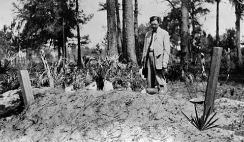
Early 20th century photograph of an African American burial on Sapelo Island, GA. African American burials were sometimes covered with personal possessions as grave offerings. Broken objects on a burial should not be treated as trash. Courtesy of Georgia Archives Vanishing Georgia Collection.
Introduction
Historical archaeologists are often asked to assist with abandoned burial grounds and cemeteries. “Abandoned” cemeteries refer to burial grounds that are no longer being used or maintained.
Many of our nation’s burial grounds were lost and forgotten as families and communities moved to new locations. While formal city and church cemeteries are the grave yards most people think of as final resting places, family and community burial grounds were common historically, especially in rural areas, and these have often been abandoned and forgotten with the passage of time. Many disenfranchised communities, such as African Americans in the South and Chinese-Americans in the West, never owned or managed the land on which their families were buried, increasing the likelihood of later abandonment. The use of informal markers, especially wooden markers, which have been lost to time, is also problematic. Landowners also sometimes removed surviving markers on an abandoned cemetery to increase the value of their property, further masking the presence of a cemetery. Finally, formal registration of burial grounds is a product of the modern era. As a result, most historic cemeteries were not recorded on deeds, plat maps or historical surveys that pre-dated those registration measures.
The SHA has created this page to share information about abandoned burial grounds with the public. This page provides resources that can be used in learning how to identify an abandoned burial ground, how to record a burial ground, and what the laws are in your area for burial grounds and cemetery protection. This web section contains information on burial ground Identification, Recording, Laws and Regulations, and Resources.
Identification
Abandoned burial grounds can be difficult to identify, even when you know the general area of a cemetery. Sometimes fencing exists to mark a cemetery’s limits but even if present, burials may also be found outside such boundaries. Burial grounds can be identified through visual inspection, as well as through archaeological techniques. Research on historic maps, aerial photographs, and in historical records can sometimes help to identify a cemetery’s location.
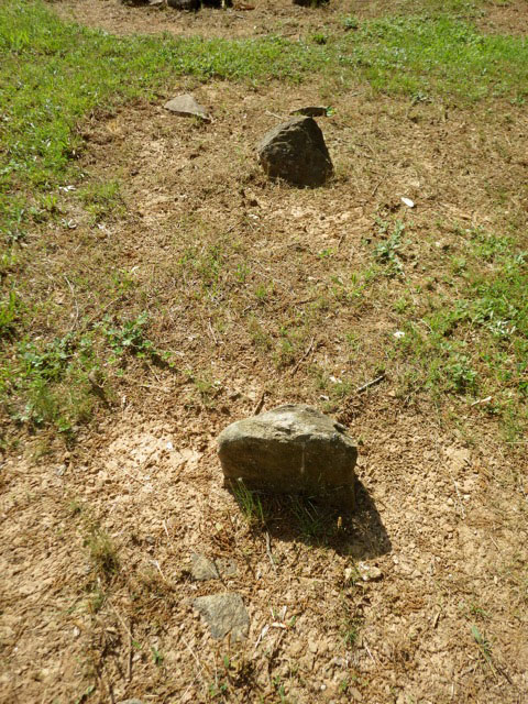
Burial marked with fieldstone rather than a formal monument.
Visual traits to look for include:
- Depressions or mounds. As burial containers and remains decay, graves typically slump. Linear depressions of several feet in length, particularly in a row, are typically the most visible evidence of burials in an abandoned cemetery. In some areas, especially in the South, the area around the grave was scraped and soil mounded over the burials. Subtle mounds may also be an indication of graves.
- Burial markers. Many rural cemeteries were not marked with formal monuments. Graves were often marked with wooden markers, which did not survive the passage of time. In areas with stone outcroppings, stones were often used to mark a burial. These were generally smaller stones with several piled against one another to serve as head stone. Homemade monuments were prepared from concrete, metal, and other materials. Construction materials, including bricks, cinderblocks, building stone and roofing tiles were also used as informal markers. Graves were sometimes marked with objects, such as ceramic pipe or broken pots. Grave borders were sometimes edged with brick, stone, shell, or bottle borders.
- Grave offerings. Members of many cultures left personal or symbolic offerings on the grave of a loved one. Broken ceramic and glass artifacts could be remnants of vases, cups, bottles, and other artifacts owned by the dead that were left on a grave. African Americans also often left seashells on the burials of members of their community. Food offerings were common in Asian graveyards. Grave offerings should be left where found and not disturbed and broken objects should not be considered trash that needs to be cleaned up.
- Domesticated flowers, trees, and shrubs were sometimes planted within a cemetery. The presence of non-native vegetation is a visual clue that a cemetery may be present. Plantings associated with cemeteries and grave locations include cedar, yucca, vinca, lilies, ferns, roses and daffodils in the East as well as cactus in the West.
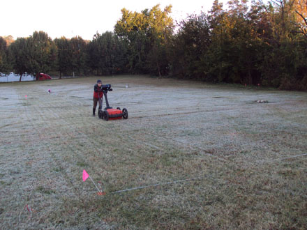
Ground penetrating radar survey of the unmarked burial section of the Elmwood/Pinewood Cemetery, NC.
Archaeological techniques for identifying grave and cemetery locations include:
- Probe survey. Historical archaeologists frequently search for unmarked graves by inserting a steel tile probe (similar to a long screwdriver shaft) into the ground on transects at a specific interval, general every two to three feet. Because the soil where a grave was dug was disturbed, these soils are softer than the surrounding soil and probing can identify these soft pockets as burial locations. Archaeologists sometimes use soil penetrometers or soil core for this work; penetrometers are probes with a pressure gauge that measures the density and compaction of the soil.
- Geophysical Survey. Ground penetrating radar (GPR), magnetometers, and electrical resistivity are all technologies that can be used to record the presence of burials. GPR is most commonly used, and sends radar waves into the ground and then records their reflection back to the GPR unit. The disturbed soil in grave shafts can be recorded by GPR as locations where the radar travels farther due to the presence of softer soils, while the GPR can also sometimes identify coffin remains as more solid features below less compact soil. GPR’s ability to read the signatures of grave shafts depends on the soil conditions, the height of the water table, the degree of prior disturbance in a location, and the skill of the operator.
- Burial Detection Dogs. Dogs have been used to track humans and to discover cadavers for a number of years, and dogs can be trained to detect buried human burials. Referred to as human remains detection dogs, this is the highest level of training for search and rescue dogs. Human remains detection dogs are particularly useful when trying to find a burial ground when the location is not known with certainty, as they can search larger areas quickly for scents that may indicate the location of a burial ground. Human remains detection dogs are used more frequently in the West, where soil and climate are more favorable for detection by scent.
- Archaeological Slot Trenching. Ultimately the only way to determine if a burial is present is to excavate a slot trench across a suspected burial location to determine if indication of a grave shaft is visible. As a disturbed location, a burial shaft can be recognized by a professional archaeologist through different soil color and texture. Slot trenching should only be done by a professional archaeologist, to avoid disturbing human remains and grave contents.
Always record your observations when surveying a cemetery. It is useful to create a sketch map showing the locations of roads, fences, and notable environmental features as well as the locations of graves themselves. It is also useful to photograph and make notes on the number of graves you were able to observe as well as any names, dates and epitaphs you could read. These observations will help others who may wish to visit the cemetery in the future. Photographs may be enhanced by using raking light. Mirrors or photographer’s reflectors can be used to shine light on a monument and help record faded and worn lettering.
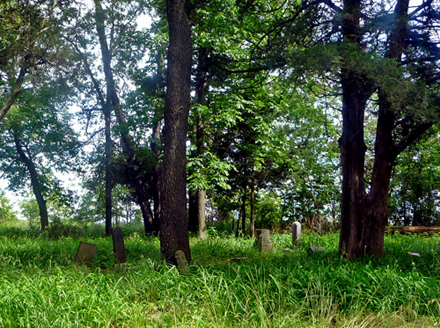
Part of the McWorter Cemetery in the summer of 2010, near the New Philadelphia National Historic Landmark in Illinois, is the subject of maintenance and restoration efforts by descendant community members (photograph by Chris Fennell)
Recording
To be officially entered into the legal land record, cemeteries must be surveyed and recorded by a licensed land surveyor and the plat of their location and boundaries added to the deed. However, land surveys can only be done with the permission of the landowner. In the absence of an official survey, we recommend that you write a letter to the county deed/title office noting that you are aware of an unmarked burial ground on a particular parcel. Your letter should include a map showing the location of the burial ground and a copy of your sketch map and it should note your association with the burial ground. For example, your letter could state “I believe this burial ground is the location of the burials of my ancestors when they worked on farms or plantations in this area,” as well as associated family names. Request that a copy of your letter be amended to the deed record for that tract of land.
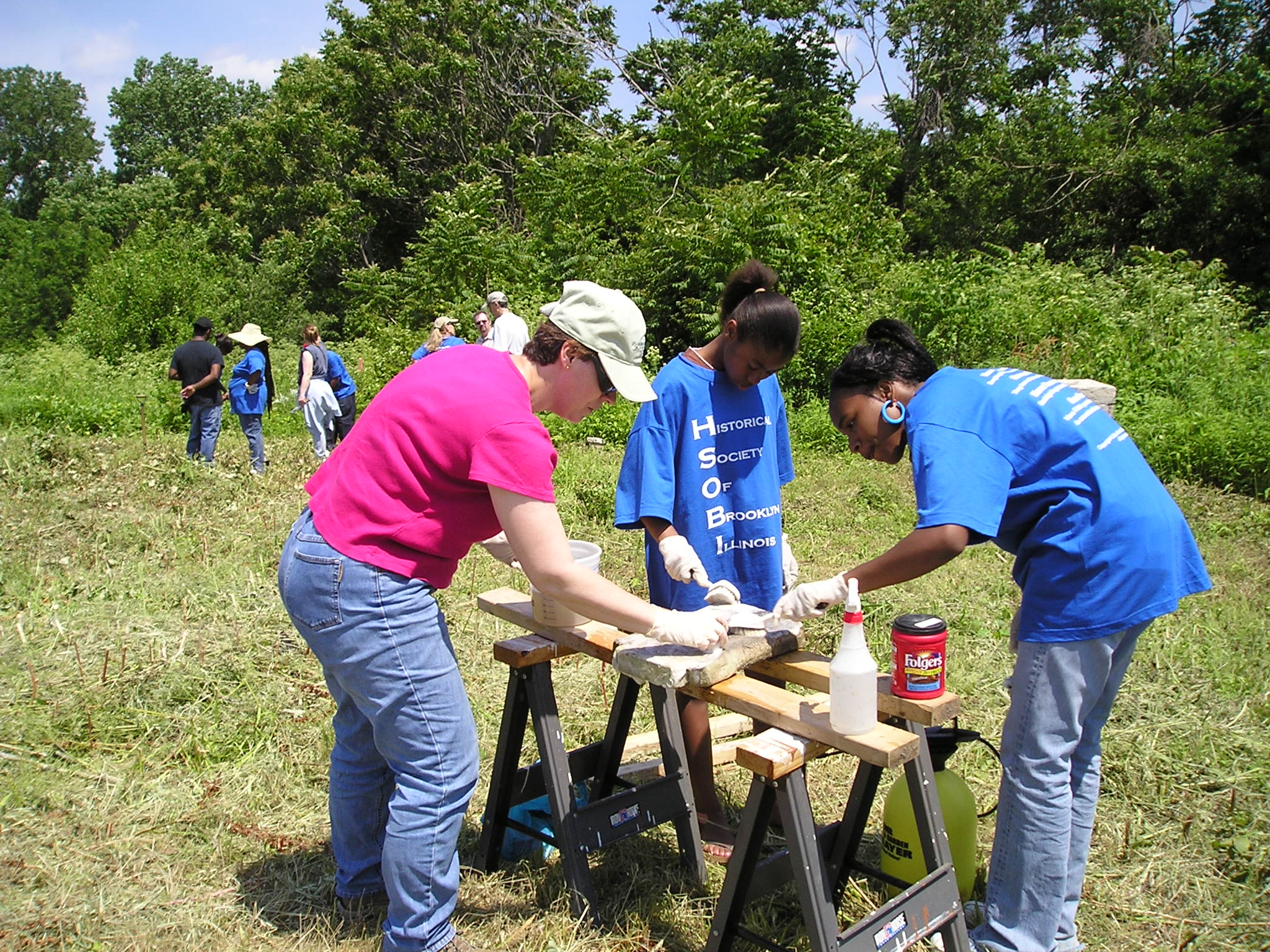
Local high school students participating in a cemetery restoration workshop in the disused Brooklyn, Illinois cemetery. Restoration of the cemetery is a joint effort of the Historical Society of Brooklyn, Illinois, the Illinois State Archaeological Survey, and the Illinois Department of Natural Resources (Courtesy of the Illinois State Archaeological Survey, University of Illinois).
You can also complete an archaeological site form for the cemetery. Each state has its own registry of known archaeological sites. Most site file records are maintained by a state government agency. You can find the site files for your state by searching the Internet for “STATE NAME archaeological site files”. Most states have site forms that can be downloaded from the Internet, completed, and returned. Upon receipt of the form, the state will issue a site number. Using a system developed by the Smithsonian Institution, the site number consists of an alphanumeric representation of your state (i.e. “9” for Georgia the ninth state alphanumerically), a two-letter abbreviation for the county your cemetery is in (i.e. DK for DeKalb), and then a sequential number that records the sequential order of numbers assigned to sites in the county. Thus, 9DK1000 represents the 1,000th site recorded in DeKalb County in Georgia. Having an official number for your site is useful, since it avoids the possibility of any confusion about your burial ground and another unmarked cemetery in that same county. It also lends weight to correspondence with landowners, government officials, and others about the burial ground. Finally, some states require that the archaeological site files be searched for known sites as part of the planning process, which ensures that land developers and others are aware of the existence of your burial ground.
You can also check to see if your county has completed a cemetery survey. State genealogical organizations, county historical societies and others have completed surveys of cemeteries over the years, although these rarely record unmarked and abandoned burial grounds. However, if your county has a cemetery survey, it may be possible to add the cemetery you are concerned with to the list of cemeteries in the survey.
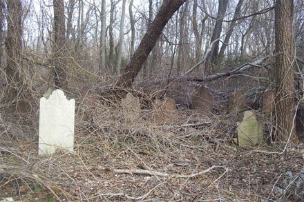
The Polhemus Family Burial Ground. An abandoned rural family burial ground in Colt Neck, New Jersey.
Laws and Regulations
There are few federal laws that pertain to human burials. The Native American Graves Protection and Repatriation Act (NAGPRA) provides direction and procedures for the treatment of Native American burials; this is the only federal law regarding human burials.
The American University Washington College of Law has developed a website that links burial laws of various states – you can find a link to their website here
https://www.wcl.american.edu/burial/
The information on this website was compiled by students in 2008 to address state burial laws specifically regarding Native American burials. It may contain errors or omissions and does not contain all state burial acts. If your state is not shown as having a burial law, you should check to see if a burial law exists.
The SHA will use this page to provide updates to burial laws that our members have identified that are not included in the Washington College of Law website. These include:
Alabama
Code of Alabama 1975, §13A-7-23.1, as amended
Desecration, defacement, etc., of memorial of dead; invasion or mutilation of corpse.
Code of Alabama 1975 §35-1-4
Right of access to cemetery on privately owned or leased property
North Carolina
http://www.ncga.state.nc.us/EnactedLegislation/Statutes/PDF/ByChapter/Chapter_65.pdf
Another provision at Chapter 70, Article 3 covers “unmarked graves and cemeteries”
http://www.ncga.state.nc.us/EnactedLegislation/Statutes/PDF/ByArticle/Chapter_70/Article_3.pdf
Florida
http://dos.myflorida.com/historical/archaeology/human-remains/abandoned-cemeteries/what-are-the-applicable-laws-and-regulations/
Nebraska
Two relevant laws which can be seen at They can be found at www.nebraskalegislature.gov/laws/browse-chapters.php?chapter=12. The Nebraska Unmarked Human Burial Sites and Skeletal Remains Protection Act(Sections 12-1201 through 12-1212) and Statewide Cemetery Registry (Section 12-1401)
Texas
Texas Historical Commission
The Texas Administration Code (Title 13, Part 2, Chapter 22, Rule §22.6) establishes the Historic Texas Cemetery (HTC) designation as a means of preservation by recording boundaries in the county deed record.
Cemetery Preservation http://www.thc.texas.gov/preserve/projects-and-programs/cemetery-preservation
Cemetery Laws http://www.thc.texas.gov/preserve/projects-and-programs/cemetery-preservation/cemetery-laws
Discovery and Notice of Existence http://www.thc.texas.gov/preserve/projects-and-programs/cemetery-preservation/discovery-and-notice-existence
Resources
National
If your burial ground is an African American cemetery with potential association with American slavery, you can register it in the National Burial Database of Enslaved Americans. You can find a link to the database here:
http://www.memorializeamericanslavery.com
The Black Cemetery Network is a collaboration between black cemetery site advocates from across the country ready to connect with you, your community, or organization.
The Society for Gravestone studies provides a number of resources on historic cemeteries.
https://www.gravestonestudies.org/
Find A Grave
www.findagrave.com
The U.S. Board of Geographic Names provides the locations of named cemeteries that appear on federal maps.
https://geonames.usgs.gov/domestic/
The Smithsonian Institution’s guide to exploring historic cemeteries:
http://anthropology.si.edu/outreach/Teaching_Activities/edcemetr.html
Florida
To report a cemetery
http://dos.myflorida.com/historical/preservation/master-site-file/documents-forms/
South Carolina
http://www.sciway.net/hist/chicora/gravematters.html
Georgia
http://georgiashpo.org/historic/cemeteries
http://www.avondaleburialplace.org
Virginia
http://www2.vcdh.virginia.edu/cem/
www.facebook.com/AfricanAmericanCemeteries
Have Questions/Need Support
Contact SHA president@sha.org