
“But underwater archaeology is already underwater…”
“But underwater archaeology is already underwater…” Considering Climate Change Impacts on Underwater Archaeological Heritage By:…
Nicole Grinnan, Research Associate, Florida Public Archaeology Network; PhD Candidate, University of St Andrews; with contributions from Jeffery Robinson, Master’s Student, University of West Florida
This blog post has been adapted from a presentation given at The Society for Historical Archaeology’s 2023 Conference on Historical and Underwater Archaeology in Lisbon, Portugal.
Though archaeology is sometimes accused of being a “dusty” science – both figuratively and literally – the field is constantly evolving as new technologies are adapted from other applications. Tools like ground penetrating radar (GPR), sub-bottom profilers, LiDAR, and laser scanners have revolutionized how archaeologists can efficiently and accurately collect data without even putting a shovel in the ground (or a foot on the seafloor). Accessible, advanced computing power in tandem with exciting software developments has also provided archaeology with the ability to process, store, and work with larger data sets.
In recent years, the Florida Public Archaeology Network (FPAN) has sought to integrate new technologies into its efforts to monitor archaeological sites at risk from the impacts of anthropogenic climate change. Many of these sites are located along Florida’s most vulnerable areas: its coastlines. In addition to concerns about “slower” climate impacts like sea level rise, the increase in devastating hurricanes striking the Florida coast have created urgency among many archaeologists in the state to get baseline records of these coastal sites before they are lost completely. In 2019, FPAN’s Northeast Region was awarded a Florida Division of Historical Resources Special Category Grant to monitor and record sites across the state through the Heritage Monitoring Scouts Florida (HMS Florida) community science program. While many of the sites visited during the duration of the grant (1,059 unique sites in total) were monitored using a standardized form, FPAN recorded 13 additional sites with its FARO Focus 350s Terrestrial Laser Scanner (Image 1). Outputs from these laser scans included point clouds, scaled 3D models and images of the sites, and Digital Elevation Models (DEMs). While only a small number of the overall sites monitored during the grant were able to be scanned, we now have a wealth of information on the status of those 13 sites at the time they were monitored.
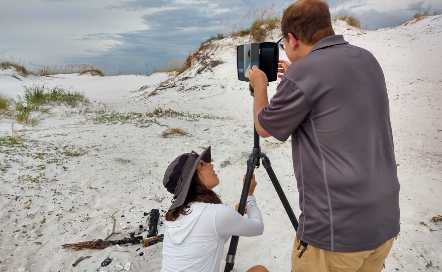
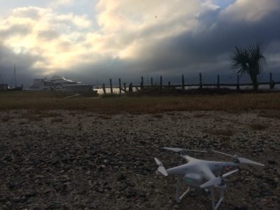
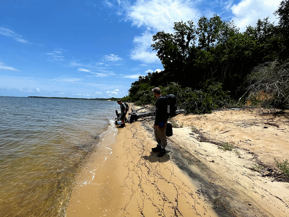
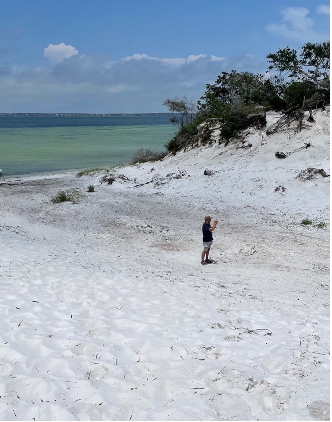
During our initial experiences with terrestrial laser scanning (TLS) in Northwest Florida, a question inevitably arose: is this a technology that can be easily applied to archaeological site monitoring across the board? While numerous talented and tech-savvy archaeologists have successfully used TLS in their work, it struck me while in the field that TLS may not be the beacon of hope for site recording that we had initially hoped it might be. Not only are TLS units expensive to purchase in the current market (often somewhere along the order of $15,000+), but they also require costly periodic recalibration and proprietary software to remove point cloud data captured in the field. These expenses may be prohibitive for research institutions and governmental agencies unless grant funds can be spent to purchase a unit. While I can’t deny the ease of pressing a button and waiting eight minutes behind a dune to capture 360 degrees of data, TLS does also require a large kit of equipment that can be extraordinarily cumbersome to get to remote sites on land (Image 2). Units are sensitive to atmospheric conditions like humidity and temperature, with almost no resistance to water (a constant fear while working in Florida’s sudden, rainy onslaughts).
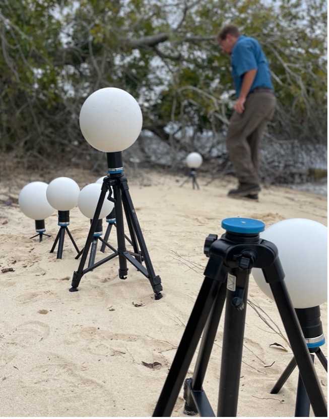
Originally designed for survey, construction, and architecture, TLS relies on the strong geometry of built environments – like right angles formed at the intersection of building walls or the high contrast between different construction materials – to align multiple scans during computer processing. Since a majority of the coastal archaeological sites we monitored in Northwest Florida were shell middens or Civil War-era earthworks, we installed white target spheres on our sites so that the TLS unit would have points with which to later align the scans (Image 3). The spheres added much more equipment to our overall kit and were often difficult to place on more tenuous landscapes like eroding bluffs. While scanning more “natural” sites like shell middens and Civil War-era earthworks was not an impossible task, it did provide for a more challenging day of scanning. In the case of sites completely covered in vegetation (as many sites are here in Florida), TLS was completely ineffective because it relies on “line-of-sight” observations.
Aware of our experiences with TLS and having worked with it during his own projects, FPAN Public Archaeology Assistant and UWF Anthropology graduate student Jeffery Robinson proposed a Master’s thesis that would compare TLS with another technology now being used in a variety of archaeology applications: photogrammetry. Like TLS, photogrammetry produces point clouds of data that can be used to create products like 3D models, DEMs, or ortho-images. Unlike TLS, photogrammetry does not require any special tool or instrument; a camera and a good photo-taking strategy is generally all that is needed to capture data. Photo scales and printed targets can be useful in areas with low geometry (like natural shorelines), but they are generally not significant in terms of cost or equipment load. Processing images to create photogrammetric products may require the purchase of certain software, though open-source and free options are available (with some limits on functionality). With the quick swap of a camera lens, photogrammetry can also capture either large scale sites and environments or small, macro-scale artifacts. For his research, Jeffery selected three at-risk sites in Northwest Florida to monitor over the course of two years with each technology: Butcherpen Mound (8SR00029) in the Gulf Islands National Seashore Naval Live Oaks Area, Middle Middens (8ES04128) on Santa Rosa Island, and the World War I-era Battery Cooper (8ES00089) also in the Gulf Islands National Seashore Fort Pickens Area. Overall, photogrammetric recording of these sites took more time than recording via TLS. The reduced equipment load for photogrammetry, however, more than made up for the time needed to set up and level the TLS unit, install spherical targets, and transport the TLS unit to and from the site (Image 4). As neither TLS nor photogrammetry can collect data on occluded site components, photogrammetry is also less useful in places with heavy vegetation.
Jeffery’s analysis of site change over time based on the TLS and photogrammetric data he produced is still ongoing, but our experiences in working with him drove home some of my early musings about whether integrating certain technologies into our everyday work was actually seamless. While I certainly don’t aspire to “singularity,” I felt that truly beneficial technology shouldn’t have myriad accessibility issues like cost, kit, and proprietary software. For that reason, recent efforts by FPAN to fully document sites in Northwest Florida have relied more on photogrammetry.
Though it may seem like this blog post is quick to dismiss the application of TLS in coastal sites monitoring based on our experiences, it is important to note that TLS can be extremely useful to record sites with high geometry (i.e., buildings and more built environments) that are accessible by road or paved path. One peripheral benefit of using our TLS unit in the field was that many passersby were extremely curious about what we were doing and how the technology worked. These impromptu outreach opportunities were excellent for discussing research with residents of and visitors to the area. Indeed, the use of TLS garnered so much attention that the local public radio station (WUWF 88.1) featured our efforts and Jeffery’s research in a three-part piece that won News Director Sandra Averhart first place in the 2021 Florida Association of Broadcast Journalist Awards in the Environmental Reporting Series category for radio (Part 1, Part 2, Part 3).
New technologies are incredible tools that archaeologists can harness to make their work easier and more efficient. As with many things, a cost-benefit analysis should be conducted prior to committing to one method. In the instance of utilizing Terrestrial Laser Scanning (TLS) or photogrammetry to monitor archaeological sites at-risk of climate impact in coastal Florida, staff in FPAN’s Northwest Region vastly preferred to photogrammetry due to its far more accessible nature. Given that the final products of both methods were virtually the same, we know how we’ll be packing for site monitoring missions into the foreseeable future.