
Your First Drone: Basic Considerations and Best Practices for Drone Use in Public Outreach
Kevin Gidusko, Florida Public Archaeology Network
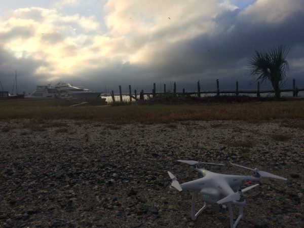
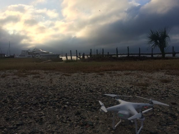
Image 1 The FPAN drone, Boas I, gets ready for flight. Photo credit: Kevin Gidusko
At some point in the near future you or someone you know is going to want to get a drone and use it somehow, someway in whatever research or outreach you are conducting. Perhaps this thought has already crossed your mind. For the most part I think this is an amazing idea, but not without its own set of serious issues to consider first. Drones, more properly referred to as unmanned aerial vehicles (UAVs), are rapidly changing the ways in which we collect data at archaeological sites, and offer us fantastic new ways to visualize that data. Those visualizations, those flashy aerials and three-dimensional models that drones help us to produce, are what inevitably intrigues the public; not to mention the hint of science fiction futurism that still clings to drones. Those of us working in public outreach are keen to take advantage of these shifts in public interest and so it is inevitable that some of us will want to procure a drone to use in outreach efforts. However, drones have also been a hot-button issue these last several years. Issues of privacy and public safety intermittently make the global media circuit, often doing a better job of spreading how best not to use a drone rather than discussing how they are being put to use by a bevy of well-meaning enthusiasts and scientists. It is imperative we demonstrate best practices to the public so that we can assist in bolstering the positive public image of these powerful tools. The first, best thing you can do when using a drone is to stay informed about the topic!
It should be noted that this post has a definite shelf-life. I give it a year tops. The drone industry and laws surrounding drone use in the U.S. and abroad are constantly changing as the technology advances and agencies charged with regulating their use play catch-up. Please be aware that any discussion below of applicable laws or rules to consider when using a drone are only good for the time being. These laws can, and probably will, change often in the next few years. This post is designed to lay out the bare-bones basic overview of purchasing a drone and using it safely around the public. I will cover a few key points, but this should not be considered an exhaustive discussion of utilizing drones in public outreach or research. The goal for this post is to create a quick, easy outline of important issues, resources, and best practices for drone use.
Who Governs the Skies?
One of the first things to consider before purchasing or using a drone is to find out who manages the airspace in your country. Many of these agencies are actively attempting to engage drone users, so finding them online should not be a problem. These are the best places to find out what kind of regulations are in place for drone use. In the U.S., the Federal Aviation Administration (FAA) manages the nation’s airspace. For drone use in the U.S. some things to remember are to:
- Register a drone with the FAA and mark it with the registration number.
- Keep drones below 400 feet and within your line of site.
- Have a basic knowledge of where drones can and cannot be used. For example, the National Park System airspace, airports, sporting events, and most airspace around military installations are no drone zones.
Every country has their own set of regulations, always be sure to find out what those may be before attempting to fly a drone. Always remember that in the U.S. drones should not be flown within 5 miles of an airport without first contacting the control tower. Many of the drones currently on the market are nearly impossible to spot by airplanes descending for a landing; it is the responsibility of the drone operator to ensure that no mishaps occur.
![]()
Image 2 Registration ID for the Boas I. Design Credit: Nicole Grinnan
What Kind of Drone?
The drone industry has an ever-increasing selection of multi-purpose or task-specific drones to choose from. How best to find the right one for you? For the most part two major considerations come into play when choosing a drone: Cost and purpose. Both of these should be carefully weighed before purchasing a drone and all of the assorted equipment inevitably needed to keep it running.
Cost: Drones range anywhere from a few hundred dollars to thousands of dollars. Naturally, cost may be the largest constraint you encounter; you only have so much to spend. More expensive drones tend to be larger, have better camera and video equipment, and can remain airborne longer. Remember also that the cost of the drone itself is only one aspect of the total cost. Extra batteries, carrying cases, replacement rotors, and standard repairs to the drone potentially add hundreds of dollars to the cost. Deciding how much to spend on a drone also has a great deal to do with its intended purpose.
Purpose: Generally speaking, more expensive drones allow for higher quality data collection and offer greater variation in use. Many less expensive drones still have great cameras, though they are not usually able to be switched out. If your goal is to use a drone to do demonstrations, take a few neat pics, and possibly collect data for 3D modeling, then one of the lower end drones on the market now (< $1000) should definitely meet your needs. If a primary purpose of the drone to be purchased is research, investing in better equipment pays off exponentially. This is especially true when you factor in the increased airtime these drones offer and the ability to, for example, switch out cameras, attach thermal imaging cameras, attach LiDAR sensors, etc.
There are several types of drones on the market that are increasingly being manufactured to suit specific needs. There is no point in purchasing a drone that is rigged for cinematography or large-scale mapping, for example, when what is needed is a small demonstration drone to be used intermittently. Think about how a drone will be used before purchasing it and decide if all the features you may want are really necessary.
How to Ensure Safety?
Drones, like many other tools we regularly use, can be dangerous. The rotors on drones spin fast and hard enough to cause serious wounds to a person. When using a drone around the public it is important to consider a few safety measures:
- Never fly the drone at or directly above a person or group. Drones can, and have, fallen from the sky or have just flown off. While not an everyday occurrence, it is nevertheless important that when operating a drone you take every precaution to ensure the safety of those around you.
- If the drone loses contact with the remote control and flies off then immediately alert nearby air traffic control towers.
- Keep a log of each flight. Record airtime, conditions, purpose, location, and note if you had to request permission to fly the drone as well as who granted it. Note every issue that occurs with the drone.
- Do not lose sight of the drone and consider flying with a spotter when using it around the public. The spotter’s job should be to make sure that the drone is within sight and not a danger to anything. This is especially helpful if the drone operator is busy speaking to a group and paying attention to live-streaming feeds from the drone.
- Consider purchasing propeller guards. These help ensure the safety of others as well as the drone itself should it bump into an object.
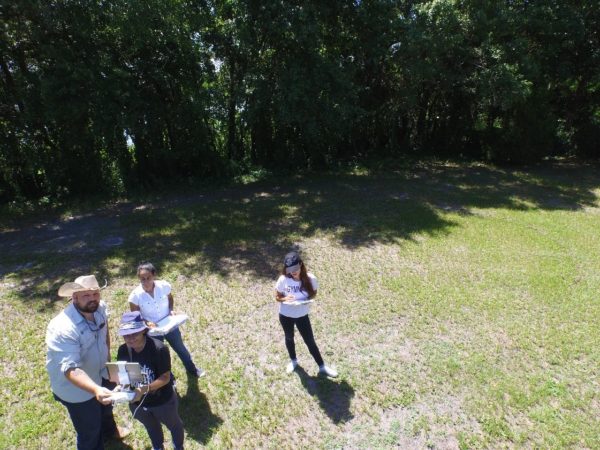
Image 3 Teaching a volunteer how drones operate. The author is acting as the drone spotter. Photo credit: Kevin Gidusko
Get Creative!
The future of archaeology is sure to see the inclusion of the drone as a standard addition to the archaeologist’s toolkit. Their use in archaeology has already captured the imagination of the public; including drones in public outreach and better educating the public about their potential applications is an easy sell. Drones can be used in teaching about aerial survey techniques, 3D photogrammetry of sites or structures, making informational videos, or even just taking pictures that offer a unique perspective.
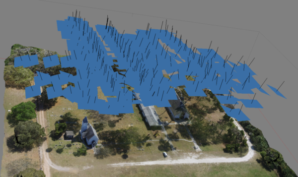
Image 4 There are plenty of software options available for use with drones. Here, a 3D model has been created with the use of Agisoft Photoscan, a 3D photogrammetry software package. Photo credit: Kevin Gidusko
The sections above have covered, incredibly briefly, a few of the issues to consider before purchasing or using a drone for your public outreach or research. The most important things to remember are to stay informed about current regulations concerning drones and to always ensure the safety of others while flying a drone. The basic points in the sections above should help guide your initial foray into the world of drones. However, a quick search online will quickly convey the depth and breadth of this topic thus far. There is a massive amount of information to wade through and even more coming around the corner. We’ve only just begun.