

North Carolina Archaeological Sites – Approaches to Handling Climate Threats
Allyson Ropp, Historic Preservation Archaeological Specialist, NC Office of State Archaeology; Ph.D. Student, Integrated Coastal…

By Laura Seifert, Fort Pulaski National Monument, Savannah, Georgia
Work began on Fort Pulaski in 1829, but before one brick could be laid, a complex ditch and dike system was dug to engineer Cockspur Island from a marshy hammock into solid ground that could support the massive brick fort. In fact, it would be several years before the first bricks were laid due to the wide scope of the ditch and dike system. In addition, storms damaged the dikes and main ditch twice in the first few years forcing workers to rebuild some of the work. Despite subsequent small changes, including more storm repairs and the Civilian Conservation Corps’ (CCC) work that fixed damage due to neglect, Fort Pulaski’s ditch and dike system has remained largely intact and held the fort steady for nearly 200 years.
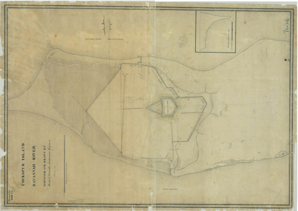
Image 1. 1843 map of Cockspur Island, showing Fort Pulaski and the surrounding ditch and dike system, which includes the wet moat around the fort and demilune. (Image courtesy of the National Archives <National Archives NextGen Catalog>)
Hurricanes and other storms are the refrain of Cockspur Island’s history. Situated near the mouth of the Savannah River, this low-lying, coastal Georgia island is very susceptible to storm damage. An 1804 hurricane largely removed an earthwork fort and wooden blockhouse from the landscape and killed half of those present. Another hurricane in 1854 lifted the Carpenter’s Shop off its foundation and swept away the building and its contents. Meanwhile, the fort’s caretakers huddled in the top floor of the only two-story building, having broken out the lower floor’s weatherboarding to allow storm surge to flow through rather than collapse the building. More recently, Hurricanes Matthew (2016) and Irma (2017) caused considerable damage. The island resembled a bathtub when storm surge water flooded over the dike then became trapped because broken culverts and clogged ditches could not let the water back out. Bridges to access the fort floated away, and historic wooden flooring in the casemates was displaced.
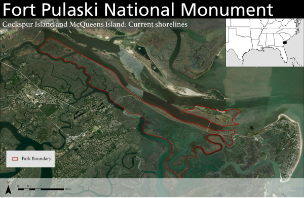
Image 2. Fort Pulaski National Monument consists of two islands: McQueens Island that is largely tidal marsh and the smaller Cockspur Island to the north, which holds Fort Pulaski itself. (Image courtesy NPS/Seifert)
Compounding these deferred maintenance problems with the drainage system, the fort faces new challenges due to human-caused climate change. Sea level rise and higher tides are obvious on the landscape and predicted to worsen. During king tides, water can be more than 10 feet over the MLLW (mean lower low water <NOAA Tides & Currents>). Rising groundwater and saltwater intrusion are the hidden threats. Park archeologists were horrified to find their units nearly full of water after a simple rain event in January 2023. This flooding severely delayed fieldwork to the extent that no fieldwork was conducted in February, and then excavation could only be conducted intermittently with breaks of several days or up to two weeks depending on the rainfall. Even when the units did not contain standing water, excavation was often conducted in very short bursts as archeologists would dig five to ten cm before encountering groundwater again. Repeated groundwater flooding sometimes caused the unit’s walls to erode. For two units, this damage, in addition to persistent groundwater, caused us to abandon and backfill the units before we reached subsoil.
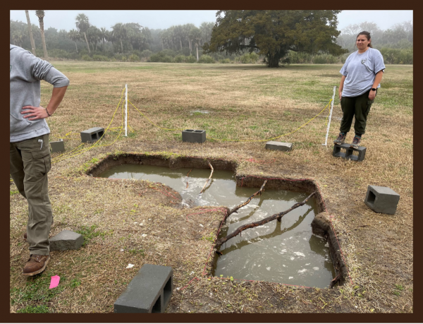
Image 3. Archaeologist Sam Matera expresses our feeling about flooded units in late January 2023. (Image courtesy NPS/Seifert)
As sea level rises, saltwater inundation will be an increasingly destructive factor. Saltwater’s effect on terrestrial artifacts can be surmised through studying marine archeological sites. More, or perhaps all, the terrestrial artifacts excavated will need to undergo conservation or different cleaning techniques due to the artifacts’ exposure to salts and salt water. There are examples from England of white clay tobacco pipes spalling after excavation because they were not desalinated before permanent storage. “Pipes from marine or estuary conditions will have absorbed salts and these need to be removed by soaking the fragments in frequent changes of fresh water for a week or two before allowing them to dry out” (Higgins 2017:5). At our most recent excavation, all the iron artifacts were severely corroded, most beyond identification, from excess amounts of water, including saltwater and brackish water. Fort Pulaski archeologists are considering soil testing to determine salinity levels to guide future laboratory methods and conservation decisions. All of the above factors will lead to greatly increased costs for archeological projects.
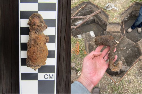
Image 4. Cutlery handle from a kitchen at the Fort Pulaski’s Workers’ Village. While the carved bone is in excellent shape, the iron has rusted and oozed everywhere. Right: Iron hook from the same site. This artifact was by far the best-preserved iron object found. (Image courtesy NPS/Seifert)
As the island becomes more saturated, soils could become less stable–essentially, a wet sponge doesn’t hold as much weight as a dry one. Park staff have begun a project to monitor Fort Pulaski with crack monitors and tilt monitors to analyze the fort’s structural stability over the next decades. While stopping sea level rise is above my pay grade, we are working on ways to adapt and keep the sponge (Cockspur Island) dry, or at least drier. One project is repairing and raising the dike to keep the water out. A group of students from Georgia Institute of Technology studied this problem for their senior capstone project and worked with the US Army Corps of Engineers (USACE), Savannah District, to develop a concept plan for raising the dike. We are currently seeking funding for the final design and implementation.
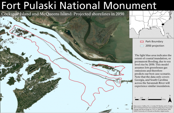
Image 5. Projected sea level rise for Fort Pulaski National Monument in 2050. Note the flooded ditch and dike system; this model assumes no alterations or improvements to the drainage system. (Image courtesy NPS/Seifert)
The complimentary project is to clean out the ditches, repair culverts, and replace tide gates to allow the island to drain, as well as being able to flush the system on a regular basis to promote a healthy wetland ecosystem. The first phase of this project took place in early 2024. It was ugly.
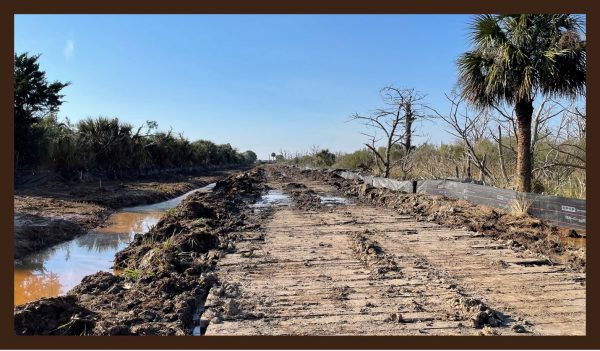
Image 6. After vegetation removal, wooden matting (right) was placed to support heavy equipment used to clean out Ditch 5, seen at left. This picture was taken after the ditch was cleaned out but before the area was reseeded. (Image courtesy NPS/Seifert)
Wooden matting was placed along the ditch, and heavy equipment was used to dig out accumulated sediment and vegetation. The culvert was repaired, and the flap gate allowing access to the Savannah River was replaced. Then the matting was removed, and the area reseeded. An archaeologist monitored the project, but few artifacts were found, which is not surprising considering the CCC picked the moat nearly clean. (Today, the park has approximately 1,000 accessioned artifacts from the CCC repairing the ditches and moat in the 1930s.)
This initial phase began with Ditch 5, which was the most severely damaged. There are still roughly 3.5 miles of ditches to repair, with varying levels of damage. For comparison, Ditch 5 is approximately one-third of a mile, which is less than 10% of the total length of the ditches. The final designs are finished, so once we receive more funding, we can complete more work. Our local USACE, the Savannah District, has been our preservation partner in engineering the work, creating plans, and contracting the project. They feel personally involved in this project. Fort Pulaski, as a US Army fort, is their legacy project, and the USACE staff is considered a descendant group.
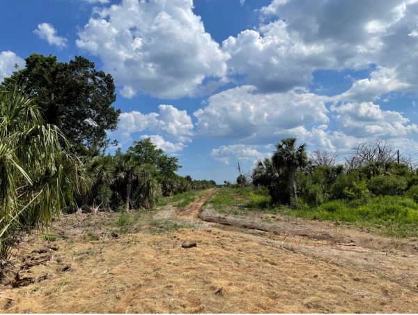
Image 7. Completed Ditch 5. Picture taken in June 2024. (Image courtesy NPS/Seifert)
Ultimately, this project should help manage water and flooding on Cockspur Island while also rehabilitating and maintaining a historic element of the cultural landscape, one that is part of our enabling legislation. As we celebrate the national monument’s Centennial in October, we look forward to keeping the fort above water and accessible to the public for another 100 years.
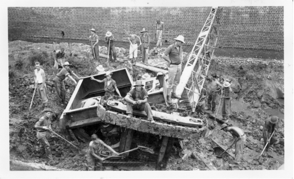
Image 8. CCC workers excavating the fort’s moat in the 1930s. It’s not going well. (Image courtesy of the Fort Pulaski archives)
Sources
Higgins, David
2017 Guidelines for the Recovery and Processing of Clay Tobacco Pipes from Archaeological Projects. September 2017. National Pipe Archive, University of Liverpool. http://www.Pipearchive.co.uk/pdfs/howto/Guidelines%20Ver%201_2%20030917.pdf